


S E R I E S
Spring-Sandusky interchange
A E S Q U E
L I N K S
AAA
Abulafia
Boardwalk
Bread
CHN
Christ Lutheran Church
Neighborhood Research Institute
Old Oaks
Olde Towne
PolyphonyBusiness First
Business First Daily Edition
Call and Post
Columbus Alive
Columbus Dispatch
Columbus Free Press
Columbus Post
Communicator News
The Daily Reporter
Inner Art
The Lantern
The Other Paper
Suburban News Publications
Short North GazetteNBC4 Columbus
WSYX 6
10TV WBNS
ONNBBC World Service
CNN
Christian Science Monitor
The Guardian
IndiaTimes
Newsday
New York Times
StarTribune
Washington Post
Washington TimesAfricaPundit
William F. Buckley Jr.
Command Post
Crooked Timber
Daniel W. Drezner
John Ellis
David Frum
Hit & Run
Instapundit
Mickey Kaus
Joshua Micah Marshall
The Note
OxBlog
Virginia Postrel
Wes Pruden
Jim Romenesko
Andrew Sullivan
Volokh ConspiracyDay by Day
Doonesbury
Ted Rall
Peter Steiner
Tom Toles
Tom TommorowCronaca
Languagehat
Language Log
Open Brackets
PaleoJudaicaCandid Colors
Communication Arts
Conscientious
Ecotone Wiki
Smoky Mountain JournalAcme Art Company
Ballet Met
CCAD
Columbus Arts
Columbus Arts Festival
Columbus Metropolitan Library
Columbus Museum of Art
Columbus Symphony
Dialogue
Franklin Park Conservatory
Glass Axis
Music in the Air
Opera Columbus
Thurber House
Wexner CenterCity of Bexley
City of Columbus
Columbus City Council
Columbus Police
Columbus Public SchoolsOTENA egroup
OTENA-NIC egroup
OTENA-tours egroup
OTENA-trustees egroup
Old Oaks egroup
Ohio Parsons Blockwatch egroup
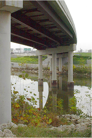
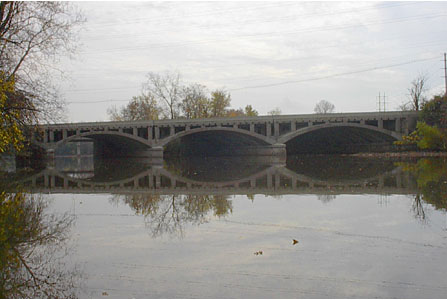
Above is the Spring Street bridge over the Olentangy River. The photograph was taken from what appears to be a never-used boat-ramp onto the river. There is no other public access in the area.
The Spring-Sandusky interchange (Map) took nearly 30 years to complete. The intersection of I-670, U.S. 33 and Ohio Rte. 315 at the confluence of the Scioto and Olentangy Rivers on the western edge of downtown Columbus, Ohio, makes for a dizzying array of overpasses, underpasses, ramps, signs and bridges.
The flood of 1913 caused the city of Columbus to shun its waterways, and the rivers are now walled off downtown and largely ignored elsewhere. Throughout the sprawling Spring-Sandusky interchange they have been treated as an obstacle to pave over and isolate.
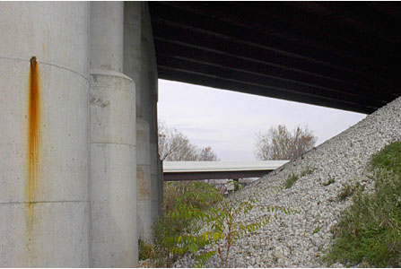
Spring St. is U.S. 33 through downtown Columbus, and it is rumored that the remains of Sandusky Street can be seen here and there beneath what is now the interstate-grade Rte. 315. Several railroads crisscross the area, complicating the interchange even further.
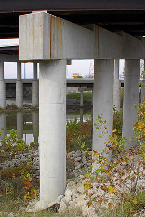
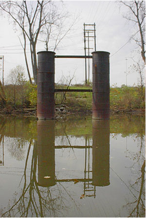
On the far side of Rte. 315, Spring Street becomes Dublin Road and curves north towards the suburb of Dublin. The abandoned piers above, which stand in the Olentangy River, are at the terminus of what was until several years ago Dublin Ave. This may have continued across the river at one time, until Spring Street was connected to Dublin Road and the old bridge removed.
Dublin Avenue is now marked West Nationwide Boulevard, a street that was continued through the old Ohio Penitentiary site into which Dublin Avenue had terminated. The buildings being renovated in this district all use the Nationwide Boulevard name, and the city of Columbus believes it has legally changed the name of Dublin Avenue to Nationwide Boulevard. Franklin County officials, however, dismiss the name change as mere "marketing" and have refused to alter their maps.
